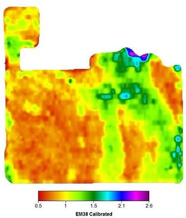
EM38 Survey
EM38 Survey is a geophysical survey with UAV mounted equipment to measure the electrical conductivity of soil. A mathematical equation then calculates the water content, building an image of good or poor water content throughout a field.
This assists farmers in knowing where the water content is – or will be – ideal for crop planting. This provides planning assistance for crop yield and better seed, fertiliser and traffic movement planning. For example, if one corner of a paddock has very poor water qualities from an EM38 survey, then the farmer should not plant crops in this area. Thus, the cost of seed, fertiliser and monitoring have all reduced. Also, soil compaction can be increased in this area as it is unsuitable for crops anyway – so plant and equipment can be placed here. This may make another area available for such storage or movements – providing an increased yield from the same overall area, simply with better land management.
Travelling Australia wide, Skyline UAV can come to you and achieve your goals quickly and easily.